
Tag: review

  • हिमाचल प्रदेश के जन-आन्दोलनों पर एक नज़र

    हिमाचल प्रदेश के जन-आन्दोलनों पर एक नज़र

    बी.एस. चैहान ‘चेत’ पी. . चिऊणी, तह. थुनाग, जिला मण्डी-175048 टी.जी.टी. कला रा.वमा. पाठशाला, छाट (छलवाटन)

    Contact: 94184-03136 email: [email protected]

    हिमाचल प्रदेश बनने से पूर्व कई प्रसिद्ध जनआन्दोलन हुए हैं। हिमाचल प्रदेश में आजादी की चिंगारी धीरेधीरे फैलती रही। बहुत लम्बे समय से यहां की जनता स्थानीय शासकों की निरंकुशता, शोषण, हिंसा और अन्याय सहती रही। काफी जुल्म सहने के बाद भोलीभाली जनता का आक्रोश फूट पड़ा है और जनता ने शासकों के विरूद्ध आन्दोलन करने शुरू कर दिए। हर इन्सान या जीव स्वतंत्र रहना चाहता है। यह अधीनता चाहे स्थानीय निरंकुश शासकों से हो या फिर विदेशी आक्रान्ताओं से। हिमाचल के पहाड़ी लोगों ने सदा ही बाहरी आक्रमकों तथा भीतरी दमन का विरोध किया है।

    हिमाचल प्रदेश में ये जनआन्दोलन तीन प्रकार से चले। एक वो जो किसी विशेष स्थान के लोगों ने अपनी स्थानीय समस्याओं को लेकर चलाये। ये अधिकांश भूमि, भूमि बन्दोबस्त, भूमि लगान , बेठबेगार, राजा या उसके कर्मचारियों की दमनकारी नीतियों के खिलाफ होते थे। 9 मार्च 1846 की सन्धि के अनुसार वर्तमान हिमाचल के अधिकांश हिस्से सिक्खों से छूटकर सीधे अंग्र्रेजी प्रशासन के अधीन आ गए, जिसके परिणामस्वरूप पहाड़ी रियासतों पर अंग्रेजों का एकाधीकार स्थापित हो गया। अब पहाड़ी रियासतों के राजा आपस में नहीं लड़ सकते थे। क्योंकि सभी शासक अंग्रेजों के अधीन थे। अंग्रेजों को सिर्फ बेगार और कर राशि से मतलब था। नूरपुर के राजा जसवंत सिंह को अंग्रेजों ने 5000 रु. वार्षिक देकर अपने कब्जे में ले लिया।

    सन् 1848 . का दूसरा अंग्रेज सिक्ख युद्ध आरम्भ हुआ उसी समय “राम सिंह” ने आक्रमण करके अंग्रेजी सेना को भगा दिया और वहां पर नूरपुर का झण्डा लहरा दिया। राम सिंह को बाद में विपरित परिस्थितियों के कारण मैदान छोड़ कर भागना पड़ा। जब वह पहाड़ों पर वापिस आया तो उसके एक मित्र द्र्रोही पहाड़ चन्द ने अंग्रेजों के हाथों उसे पकड़वा दिया। अंग्रेजों ने राम सिंह को काले पानी की सजा देकर उसे सिंगापुर भेज दिया। नूरपुर रियासत के इतिहास में वजीर राम सिंह का महत्त्वपूर्ण योगदान है।

    1857 के विद्रोह का प्रभाव हिमाचल की पहाड़ी रियासतों पर भी पड़ा। यहां पर जहां एक ओर देशभक्तों ने अंग्रजों के विरूद्ध आवाज उठाई तो वहीं दूसरी ओर अनेक राजाओं ने विद्रोह को कुचलने के लिए अंग्रेजों का साथ भी दिया। 1857 . के विद्रोह के परिणामस्वरूप रामपुर के राजा शमशेर सिंह ने अंग्रेजी सता के विरूद्ध आवाज उठाई। उस समय उस सेना में अधिकांश सैनिक गोरखा और राजपूत थे। स्वतन्त्रता प्राप्ति हेतु संघर्ष तेज करने के लिए प्रदेश में कई स्थानों पर प्रजामण्डलों की स्थापना की गई। स्वतन्त्रता पूर्व बुशहर, शिमला हिल स्टेटस में शामिल था। 1939 . में लुधियाना में “All India State Peoples” हुई, जिसमें “The Himachal Riyasti Praja Mandal” की स्थापना की गई। बुशहर में प. पदम देव ने प्रजामण्डल का नेतृत्व किया।

    हिमाचल प्रदेश के जनआन्दोलन इस प्रकार है।

    1. सुकेत जनआन्दोलन (1862-1876)- सुकेत के राजा उग्रसेन का वजीर नरोत्तम एक अत्याचारी प्रशासक था। जनता उससे बहुत दुःखी थी। उसने कुछ ब्राह्मण परिवारों पर दण्ड लगाया था। लोगों ने इसका विरोध किया और गिरफ्तार करने की मांग की। राजा के पुत्र रूद्र सेन ने भी उस वजीर का विरोध किया। अन्त में राजा ने वजीर नरोत्तम को हटा दिया और उसके स्थान पर ‘धुंगल’ को वजीर बनाया।

    2. नालागढ़ जनआन्दोलन (1877)- नालागढ़ के हिंडूर की राजगद्दी पर राजा ईश्वरी सिंह 1877 . में बैठा था। उसके समय में राजा का वजीर गुलाम कादिर खान था। इसने प्रजा पर नए कर लगा दिए और भूमि लगान बढ़ा दिए। इसका नालागढ़ की प्रजा ने विद्रोह किया। अन्त में राजा को जनता की मांगों को मानने के लिए विवश होना पड़ा और वजीर कादिर खान को निकाल दिया गया।

    3. सुकेत जनआन्दोलन (1878)- सुकेत का जनआन्दोलन 1878 . में हुआ। 1876 . में रूद्रसेन गद्दी पर बैठा, फिर उसने ‘धुंगल’ को वजीर बनाया था, उसने किसानों और जमींदारों पर नए कर लगा दिए। किसानों पर चार रु’ ‘आठ रु’ प्रति खार लगभग 8 क्विंटल कर लगाया। इस कर को वजीर ‘धुंगल’ ने‘ ‘ढाल’ नाम दिया। लोगों ने राजा से न्याय की मांग की परन्तु राजा ने इस पर कोई ध्यान नहीं दिया इस पर लोगों ने आन्दोलन करने शुरू कर दिए और अन्त में राजा को भी गद्दी से हटा दिया गया। सारे कर हटा दिए।

    4. चम्बा का किसान आन्दोलन (1895)- चम्बा का किसान आन्दोलन 1895 में हुआ। उस समय चम्बा रियासत का राजा शाम सिंह था। राजा शाम सिंह और उसके वजीर गोविन्द राम के प्रशासन में किसानों पर भूमिलगान का भारी बोझ था। इसके अतिरिक्त बेगार भी अधिक ली जाने लगी। अतः लोगों ने राजा से लगान कम करने और बेगार बंद करने के लिए अनुरोध किया, परन्तु राजा ने कोई परवाह न की। यह देखकर चम्बा के भटियात क्षेत्र के किसानों ने इसके विरूद्ध आन्दोलन आरम्भ कर दिया। रियासत की सरकार ने इसे विद्रोह का नाम देकर दबाने का प्रयास किया परन्तु वह असफल रही। फिर अंग्रेज सरकार ने हस्तक्षेप करके इसे दृढ़ता से दबा दिया।

    5. बाघल में भूमि आन्दोलन (1897)- बाघल में 1897 . में रियासत के राजा ध्यान सिंह के समय में अत्यधिक भूमि लगान के विरोध में 1902 तक लोगों ने आन्दोलन चलाया। भूमि लगान में भारी वृद्धि, चारागाहों की कमी तथा उन जंगली जानवरों के मारने पर रोक लगाने, जो किसानों की फसलों को नष्ट कर देते थे, के विरोध में किसानों ने आन्दोलन किए।

    6. क्योंथल में भूमि आन्दोलन (1897)- 1897 . में क्योंथल रियासत में भी भूमि आन्दोलन हुआ। चार परगना के लोगों ने लगान और बेगार देना बन्द कर दिया। अंग्रेज अधिकारी सैडमैन और टामस ने इस असंतोष को समाप्त कराने के लिए राजा बलवीर सेन से कहा परन्तु वह असफल रहा। अतः में अंग्रेज सरकार ने मियां दुर्गा सिंह को बतौर मैनेजर बनाकर 11 जुलाई 1898 को नियुक्त किया जिसने इस आन्दोलन पर काबू पा लिया।

    7. ठियोग और बेजा में आन्दोलन (1878)- बेजा और ठियोग ठकुराइयों में भी 1898 में विद्रोह की स्थिति उत्पन्न हुई। बेजा की जनता ने ठाकुर के विरूद्ध आन्दोलन किया तथा रियासत के दो सिपाही भी बंदी बना दिए। बेजा के शासक उदय चंद ने अंग्रेजों की सहायता से इस आन्दोलन को दबा दिया। ठियोग ठकुराई में बंदोबस्त में गड़बड़ी के विरोध में 1898 में ही किसानों द्वारा आन्दोलन चलाया गया, और किसानों ने बेगार देने से इंकार कर दिया। रियासती सरकार ने अंग्रेज सरकार की सहायता से लोगों को शांत किया गया।

    8. बाघल में विद्रोह (1905)- बाघल रियासत में 1905 में पुनः विद्रोह हुआ। उस समय बाघल रियासत का राजा विक्रम सिंह था जो उस समय अवयस्क था। इसलिए राज्य का प्रबन्ध मियां मान सिंह के हाथ में था। इस विद्रोह का आरम्भ राज परिवार के आंतरिक षडयंत्र से हुआ।

    9. डोडरा क्वार में विद्रोह (1906)- 1906 . में बुशैहर के गढ़वाल के साथ लगते क्षेत्र डोडरा क्वार में एक विद्रोह हुआ। इस क्षेत्र का प्रशासन राजा की ओर से किन्नौर के गांव ‘पवारी’ के वंशनुगत वजीर परिवार के ‘रणबहादुर सिंह’ के हाथ में था। उसने राजा के विरूद्ध विद्रोह करके डोडराक्वार को अपने कब्जे में करने का प्रयास किया। वहां की जनता ने भी उसका साथ दिया था। परन्तु बाद में रणबहादुर सिंह को कैद कर लिया और उसे मुक्त भी किया गया परन्तु शिमला में उसकी मृत्यु हो गई।

    10. मण्डी में किसान आन्दोलन (1909)- मंडी में राजा भवानी सेन के समय में 1909 में किसानों द्वारा आन्दोलन किया गया। राजा के वजीर ‘जीवानंद पाधा’ के अत्याचार और उसके द्वारा रियासत में फैलाए गए भ्रष्टाचार तथा आर्थिक शोषण से वहां की जनता परेशान थी। ऐसी स्थिति में सरकाघाट क्षेत्र से शोभाराम 20 व्यक्तियों का एक शिष्ट मण्डल अपनी शिकायतों को लेकर राजा के पास मण्डी आया। राजा ने वजीर की बातों में आकर शिकायतों की ओर ध्यान नहीं दिया। अन्त में राजा भवानी सेन को अंगे्रजी सरकार से मदद लेनी पड़ी। बाद में जनता की मांग पर वजीर जीवानंद को पदच्युत कर दिया गया और राजेन्द्र पाल को राजा का सलाहकार नियुक्त किया गया। इसके बाद मण्डी के किसानों के करों में कमी की गई और जनता की मांग पूरी होने के बाद आन्दोलन समाप्त हो गया।

    11. सुकेत में जनआन्दोलन (1924-26)- सुकेत में 1878 . के बाद 1924-26 में भी एक जनआन्दोलन हुआ था। सुकेत के राजा लक्ष्मण सेन के काल में जनता से जरूरत से अधिक लगान लिया जाता था। बेगार प्रथा भी जोरों पर थी। राजा के नाम से ‘लक्ष्मण’ कानून चलाया जाता था। 1924 में जब बेगार, लगान और करों से जनता परेशान हो गई, तब जनता ने आन्दोलन शुरू किया। इस आन्दोलन का नेतृत्व सुन्दरनगर (वनैड) के मियां रत्न सिंह ने किया। लोगों ने मियां रत्न सिंह के नेतृत्व में कचहरी का घेराव किया। स्थिति को नाजुक देखकर रत्न सिंह ने लोगों को शान्त रहने का कहा। मियां रत्न सिंह और उसके साथियों को गिरफ्तार कर लिया गया और लोगों को डरा कर यहांवहां कर दिया। 42 व्यक्ति पकड़े गए और उन्हें जालन्धर, रावलपिंडी आदि जेलों में रखा गया।

    12. सिरमौर में आन्दोलन (1929)- 1929 में भूमि बन्दोबस्त के विरोध में सिरमौर मेें पांवटा साहिब और नाहन में लोगों ने पं. राजेन्द्र दत्त के नेतृत्व में आन्दोलन किया। राजा अमर प्रकाश और अंग्रेज सरकार को पांवटा के लोगों ने संदेश भेजे। राज्य सरकार के कहने पर आन्दोलन को दबाने का प्रयास किया और थोड़े समय के बाद सिरमौर में जनआन्दोलन शान्ति से समाप्त हो गया।

    13. बिलासपुर में जनआन्दोलन (1930)- बिलासपुर में 1930 मेें भूमि बन्दोबस्त के कारण जनआन्दोलन हुआ। सबसे पहले परगना बहादुरपुर के लोगों ने बन्दोबस्त के विरूद्ध आन्दोलन शुरू हुआ। उन्होंने बन्दोबस्त के कर्मचारियों को लकड़ी, दूध, घी, रोटी आदि मुफ्त देना बन्द कर दिया। बहादुरपुर के लोगों ने तंग आकर पटवारियों के पैमाईश के सामान को तोडफोड़ दिया। पुलिस नमहोल गांव मेें मेले के अवसर पर एकत्रित कुछ आन्दोलनकारियों को पकड़कर बिलासपुर ले गई। कुछ आन्दोलनकारियों को हिरासत में लेकर जेलों में बन्द कर दिया। पुलिस द्वारा इस बगावत में डण्डा चलाने के कारण इस आन्दोलन का नाम ‘डाण्डरा’ आन्दोलन पड़ गया।

    14. सिरमौर का पझौता किसान आन्दोलन (1942-43)- जब सिरमौर के ऊपरी क्षेत्र पझौता में किसान आन्दोलन शुरू हुआ उन दिनों दूसरा विश्वयुद्ध जोरों पर था। बंगाल मेें भारी अकाल पड़ा था। अनाज की कमी हो रही थी। इसलिये रियासती सरकार ने किसानों पर रियासत से बाहर अनाज भेजने पर रोक लगा दी जहां बेचने पर अच्छे मूल्य मिलते थे। किसानों को यह भी आदेश दिया गया कि वे लोग अपने पास थोड़ा अन्न रखे शेष अन्न सरकारी कोआपरेटिसव सोसायटियों मंे बेच दें। पझौता के गांव टपरौली में अक्तूबर 1942 को किसान एकत्रित हुए और स्थिति से निपटने के लिए ‘पझौता किसान सभा’ का गठन किया। इस सभा के प्रधान ‘लक्ष्मी सिंह’ गांव कोटला तथा सचिव वैद्य सूरत सिंह कटोगड़ा चुने गये। इनके अलावा इस सभा में मियांचूंचूं, मियां गुलाब सिंह आदि शामिल थे। इस आन्दोलन का समूचा नियंत्रण व सचांलन वैद्य सूरत सिंह के हाथ में था। उसने राजा राजेन्द्र प्रकाश को पत्र लिखकर अनुरोध किया कि वह स्वयं लोगों की परेशनियां जानने के लिए इलाके का दौरा करें। परन्तु राजा अपने कर्मचारियों की चापलूसी पर आश्रित था। कर्मचारियों ने राजा को लोगों से मिलने नहीं दिया।
  • Himachal Pradesh – Heritage Tourism

    Himachal Pradesh – Heritage Tourism

    This article will give you a quick review of Heritage Tourism in Himachal Pradesh. This information is useful if you are planning to appear for any exam for government post in Himachal.

    Gurkha Castles

    The castles that were suggestive of Gurkha rule back in the times have become historical heritage of Himachal Pradesh now. Though most of them stand in ruins, it is their historical value that is keeping them alive. Gurkhas had control over some major and minor princely states in Himachal until 1815 and some important forts built by them are: The Subathu Fort It is at distance of 70 km from Malaon is now under the Indian Army’s 14 Gurkha training centre. The fort still houses some cannons that are believed to be 200 years old. These cannons because of the historic value are the centre of attraction for everybody who visits the fort.

    Dhar Mountain Fort

    The fort is located off the Kalka-Shimla national highway, near Dr. Y.S. Parmar Horticulture and Forestry University on theSolan-Rajgarh road. It is perched on top of the Dhar Mountain that is around 1,999 ft high and gives an excellent view of Nauni, a near by locality. It is in ruins and the footway that leads to it is rough and rocky. This historic fort was built around 200 years ago when the Gurkhas won the princely state of Baghat. The central entrance to the fort is a galleried hall that is facing the east and there’s a big water tank kept in the centre. The ceiling of the upper storey is quite low and were kept low-heighted intentionally so that the soldiers could fight the invaders (the British Army) in a crawling pose and ensure safety of the same time.

    The third hall at the fort is a place where visitors can witness amazing engineering skills of the Gurkhas. There’s an oval-shaped room facing east and this is the reason the roof at this part of the fort has not collapsed even after so long.

    Malaon Castle

    Situated near Nalagarh of Solan district this fort was built by Amar Singh Thapa, the greatest Gurkha leader in History. The fort stands as a symbol of one of Amar Singh Thapa’s steps to conquer the hill states in the west to expand his territory and increase his strength. It was in the year 1915 that Bhakti Singh Thapa was defeated and killed by Major General David Ochterlony who led the British army. Right
    after his victory on Bhakti Singh Thapa, Major Ochterlony compelled Amar Singh Thapa to leave the Ramgarh Fort. Later, he built the Malaon Castle as a refuge.

    [siteorigin_widget class=”InsertPagesWidget”][/siteorigin_widget]

    Banasar Gurkha Fort

    It is situated off the Kalka-Shimla highway on Kumarhatti-Nahan road at a distance of about 22 km. Over 150 years old, the fort is just one kilometre from Banasar village. Buddhist Padma Palace Monastery of Tabo in Spiti. It is more than a thousand years old. Its fine wall-paintings and stucco statues has been declared a World Heritage Site. Private Forts, Palaces, and Residences Some well preserved architecture and cobbled Himachal’s forts, palaces and residence are privately owned and the discretion of their use rests with their owners. Examples include Padama Palace Rampur, The Palace, Sarahan, Jandrighat, Dalhousie, The Palace, Jubbal. The Palace, Sunni, and The Palace, Nahan. These palaces provide visitors an insight into local lifestyles, cuisine and culture.

    Arki Fort and Palace

    At a distance of 38km from Shimla, Arki is a small town situated at 4100 ft above sea level in the Solan district. Arki Fort is one of the famous historical sites near Shimla. Arki was the former capital of the  ancient hill-state of Baghal, which was founded by a Ajai Dev, a Panwar Rajput during 1660-1665AD. The state was founded around 1643 and Arki was declared its capital by Rana Sabha Chand in 1650. The  Arki Fort was built between 1800 and 1805 by Rana Prithivi Singh, a descendent of Sabha Chand. The fort was captured by the Gurkhas in 1806 and Rana Jagat Singh, the ruler of Baghal had to take refuge in Nalagarh. From 1806 to 1815, the Gurkha General Amar Singh Thapa made use of Arki to further his advances in Himachal Pradesh. Rana Jagat Singh got back the control of Arki afterwards.

    Jubbal Palace (Near Shimla)

    It is situated at an altitude of 7000ft above sea level is one of the popular heritage sites in Himachal Pradesh. Designed by a French architect in 1930, the Palace architecture is a blend of Chinese. Indian and  European styles. The Jubbal Palace is coloured in cream hue and has sloping roofs and red chimneys. The lower portion of the Palace, known as Rana’s abode, consists of sandstone and is noteworthy for the vast stacks of deodar timber used in its structure. The modern wing of the Palace has an Indo-European design with convoluted wooden ceiling. The deodar wood from the surrounding forest was used for the construction of the Palace structures. Another beautiful aspect is the stunning display of the collection of ancient guns used by the royal families of Jubbal.

    Dagshai

    At a distance of 14km from Kasauli and 18km from Solan, Dagshai is one of the oldest cantonment towns in the Solan district of Himachal Pradesh on top of a 5689 feet hillock on Kalka-Shimla Highway. Dagshai was founded in 1847 by the East India Company by securing five villages from Maharaja of Patiala, Bhupinder Singh. The village were Dabbi, Badhtiala, Chunawad, Jawag and Dagshai. The new cantonment was named after the largest Dagshai village. The name Dagshai, according to a popular local legend was derived from Daag-e-Shahi. During the Mughal times a Daag-e-Shahi (royal mark) was put on the forehead of the criminals before they were sent off to the Daghsai village. Under British rule, Dagshai developed into a major cantonment town and also housed a large prison. Construction of the jail began in 1849 and included 54 cells.

    Kalka-Shimla Railway

    At a distance of 84km from Shimla, Kalka is a town located in Haryana State. Kalka Railway station is the northern terminus of the Delhi-Kalka line and the starting point of the Kalka-Shimla railway line. This railway was added to the UNESCO world heritage list in the July 2008. A ride in the toy train is one of the top things to do in Shimla and it is extensively used in promotion of Himachal tourism. The Kalka-Shimla Railway was built by the British to provide access to their summer capital of Shimla. The distance of 96km between Shimla and Kalka passes through 102 tunnels 864 bridges and 900 curves. There are more than 20 stations in this route. It connects Kalka at an altitude of 656 m to Shimla at 2975m.

    Kuthar Fort (Near Shimla)

    At a distance of 52km from Shimla and 3.5 km from Solan, Kuthar Fort is located in Solan districof Himachal Pradesh. Kuthar Fort is about 800 years old and it is one of the main places to visit near Solan.
    Sprawling over an expanse of 52.8km, this fort features beautiful gardens, fresh water springs and ancient temples within the complex.

    [siteorigin_widget class=”InsertPagesWidget”][/siteorigin_widget]

    Naggar Castle (Near Manali)

    At a distance of 20km from Manali Bus Stand and 22km from the Kullu bus stand, the Naggar castle is a famous castle located in Naggar. It is one of the best places to visit in Manali. The castle overlooks the Kullu valley. From the castle one could see the far off snowcovered peaks, the Beas Valley below and the green hill sides dotted with apple orchards. The Naggar castle is a magnificent historical structure. The castle was built by Raja SidhiSingh in 1460 in an impressive combination of European and Himalayan architecture. The castle has traditional architecture called Kathkooni, which uses a combination of stones and wooden beams.

    Shimla

    Shimla, the state capital of Himachal Pradesh, has some of the world’s finest examples of British-colonial architecture. There is the English renaissance-inspired grey-stone former Viceregal Lodge (now the Indian Institute of Advanced Study), the neo-Gothic structures of the Gaiety Theatre and the former Imperial Civil Secretariat (now the Accountant General’s Officer). The Tudor-framed Barnes Court (now
    the Raj Bhavan), the Vidhan Sabha and the Secretariat of the Government of Himachal Pradesh,. Colonial buildings can be found elsewhere in the state, especially, in the hillstations of Kasauli and Dalhousie.

    Dharamshala

    At a distance of 9 km from McLeod Ganj 16 km from Kangra, 237 km from Shimla, and 486 km from Delhi, Dharamshala is hill station in Kangra district of Himachal Pradesh. At an average altitude of 2,475 above sea level, it is one of the best places to visit in Himachal and among the most famous hill stations near Delhi. This is the gateway to the Kangra valley and also the headquarters of Kangra district. The
    city was destroyed by a massive earthquake in the year 1905 and was reconstructed to become a health resort and a popular tourist destination. In the year 1960, Dharamshala became a temporary headquarters of His Holiness Dalai Lama. It is known as Little Lhasa or Dhasa, because of its large population of Tibetans and Buddhists.

    McLeodganj

    At a distance of 9km from Dharamshala, 249 km from Shimla, and 490 km from Dehli. McLeodganj is in Kangra District of Himachal Pradesh. Surrounded by the Dhauladhar ranges, it lies at an average altitude of 2082 m. Considered as a twin city of Dharamshala, McLeodGanj is one of the popular Places to visit in Himachal Pradesh. Earlier, McLeodGanj was inhabited by the indigenous Gaddi tribes and dominated by one of the world’s earliest royal clans – the Katoch Dynasty. Later, it came under the rule of the British after Second Anglo-Sikh War in 1849 AD and was named after Sir Donald Friell McLeod,
    Lieutenant Governor of Punjab. Initially it was a summer resort of the British during the 1840s and became a garrison town in the 1850s.

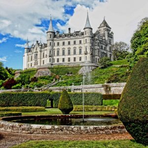
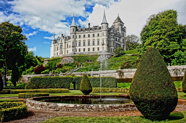
    Picture from: https://pixabay.com/en/dunrobin-castle-architecture-453164/


    [siteorigin_widget class=”InsertPagesWidget”][/siteorigin_widget]
    [siteorigin_widget class=”WC_Widget_Products”][/siteorigin_widget]
  • हिमाचल – अर्थव्यवस्था (Hindi)

    हिमाचल – अर्थव्यवस्था (Hindi)

    अर्थ व्यवस्था

    हिमाचल प्रदेष एक कृशि प्रधन प्रदेष है। सन् 1948 में हिमाचल बनने से पूर्व इस क्षेत्रा के लोगों के आर्थिक विकास और समाज कल्याण के लिए कम ध्यान दिया जाता था। तत्कालीन रियासतों में से कोई भी आर्थिक रूप से सुदृढ़ नहीं थीं। रियासतों के षासक अपने क्षेत्रों को विकसित करने की इच्छा भी नहीं रखते थे। राजा लोग अपने रंगों में रंगे होते थे और प्रजा के प्रति उनका व्यवहार प्रायः नकारात्मक था और प्रजा बेचारी असहाय होती थी। लोग गरीब और साध्नहीन थे। परिवहन के साध्न न होने के कारण वे खेतों में पैदा किए गए अनाजों, सब्जियों, फलों व अन्य वस्तुओं को बाजार तक नहीं पहुंचा पाते थे। उनकी आर्थिक स्थिति दयनीय थी। अंग्रेजों ने भी अपने अध्ीन क्षेत्रों की ओर ध्यान नहीं दिया। लोग अपने गुजारे के लिए केवल जमीन पर ही निर्भर रहते थे। लोगों के पास थोड़ी बहुत उपजाऊ भूमि ही होती थी। आम किसान पहाड़ की हिमाचल के गठन के पष्चात् प्रदेष के लोगों और सरकार ने अपनी तथा प्रदेष की आर्थिक स्थिति को मजबूत बनाने के लिए प्रयास आरम्भ किए। आज हिमाचल की आर्थिक अवस्था कृशि, बागवानी, जल विद्युत, सड़कों और परिवहन पर पूर्णतया आधरित है।

    कृशि

    हिमाचल प्रदेष के लोगों का मुख्य व्यवसाय कृशि है। 76 प्रतिषत जनसंख्या इस पर निर्भर है। यदि उन लोगों की भी गिनती की जाए जो परोक्ष रूप से कृशि पर निर्भर है तो हम कह सकते हैं कि 92 प्रतिषत लोग अपनी आजीविका इस महत्त्वपूर्ण व्यवसाय से पैदा करते हैं। कृशि के कार्य से राज्य के घरेलू उत्पादन में 50 प्रतिषत षु( लाभ होता है। अर्थ व्यवस्था में कृशि के महत्त्व को सम्मुख रखते हुए इस कार्य को पांचवें दषक से ही प्राथमिकता दी जाने लगी। अनाज और दूसरी नकदी फसलें, सब्जियां, तिलहन, अदरक आदि का अध्कि उत्पादन हुआ। हिमाचल प्रदेष में अध्कितर क्षेत्रा दुर्गम होने के कारण योग्य नहीं है। वे केवल वनों, घासनियों और चरागाहों के रूप में प्रयोग योग्य हैं। केवल 11 प्रतिषत भूमि ही कृशि योग्य है। अच्छी पैदावार प्राप्त करने के उद्देष्य से प्रदेष सरकार और कृशि विभाग ने कार्यक्रम तैयार किए ताकि लोगों को अपनी भूमि से दो से अध्कि फसलें प्राप्त हों। इस दिषा में अपेक्षाकृत प्रगति भी हुई है। आलू और सब्जियों के बीज के लिए हिमाचल प्रदेष समस्त भारत में प्रसि( है। खाद्यानों में भी इसी भान्ति अच्छी उपलब्ध् हो रही है।


    [siteorigin_widget class=”InsertPagesWidget”][/siteorigin_widget]

    जलवायु

    प्रकृति ने हिमाचल प्रदेष को कृशि योग्य जलवायु और भौगोलिक विभिन्नताओं से परिपूर्ण बनाया है। हिमाचल प्रदेष के निचले और घाटी क्षेत्रों में जहां आर्द्र और सुहावना जलवायु होता है वहीं प्रदेष के ऊपरी क्षेत्रों, जैसे किन्नौर, लाहौलस्पीति और चम्बा की पांगी तहसील आदि में षुश्क जलवायु है। कहीं भारी वर्शा तो कहीं बर्फ और कहीं बिल्कुल सूखा पड़ा रहता है। औसतन सूखे क्षेत्रों में वार्शिक वर्शा 25 से.मी. और कांगड़ा घाटी में 250 से.मी. होती है। इसमें से लगभग 75 प्रतिषत वर्शा जून से सितम्बर माह तक होती है। प्रदेष को जलवायु की विविध्ता के लिए छोटा भारत कहा जा सकता है, क्योंकि विभिन्न जलवायु यहां देखने को मिलती है।

    प्रदेष के अध्किांष क्षेत्रों में मिट्टðी का प्राकृतिक रूप देखने को मिलता है। कांगड़ा में एसिड की मात्रा वाली मिट्टðी की बहुतायत है। भूमि की मिट्टðी में भी भिन्नता है। अध्कि वर्शा वाले क्षेत्रों में चिकनी व दोमट किस्म की और ऊपरी क्षेत्रों की रेतीली मिट्टðी होती है। कृशिजलवायु के आधर पर प्रदेष को चार खण्डों में विभक्त किया जा सकता है।

    1. षिवालिक पहाड़ी खण्डइस खण्ड में तलहटी और घाटी क्षेत्रा, जो समुद्र तल से लगभग 800 मीटर की ऊंचाई पर है, जलवायु अ(र्ऊश्ण होती है। इस खण्ड में प्रदेष का 35 प्रतिषत वनों और 33 प्रतिषत कृशि योग्य क्षेत्रा आता है। भूमि दोमट किस्म की है। भौगोलिक बनावट के कारण पूरे क्षेत्रा में जंगल कहींकहीं ही उग सकते हैं। जलवायु में आर्द्रता की कमी होती है। इस क्षेत्रा में वार्शिक वर्शा लगभग 150 से.मी. तक होती है, जिसमें से 75 प्रतिषत केवल मानसून में ही होती है। अनियमित और अपर्याप्त वर्शा के कारण बाकी मौसम में फसलों पर कुप्रभाव पड़ता है। फसलें अच्छी नहीं होती। कटाव वाला क्षेत्रा होने से पहाड़ी नालों आदि से भूमि का उपजाऊपन प्रायः नश्ट होता रहता है। घाटी के क्षेत्रों में सिंचाई सुविध या तो नालों से पानी को मषीनों द्वारा उठाकर अथवा कुओं और टयूबवैलों तथा टैंकों द्वारा उपलब्ध् कराई गई है।

    प्रमुख फसलें गेहूं, मक्की, धन, चना, गन्ना, सरसों आदि की हैं तथा आलू, अन्य सब्जियां और संगतरा, आम, अमरूद, लीची और नीम्बू प्रजाति के फल आदि उगाए जाते हैं। फसलों का उत्पादन चक्र वर्शा की स्थिति के अनुसार मक्कीगेहूं, चन्नामक्की, मक्कीसरसोंगन्ना आदि हैं। फिर भी सिंचाई की स्थिति के अनुसार निम्नलिखित फसलों का चक्र प्रयोग में लाया जाता हैः

    1) मक्कीगेहूं, 2) मक्कीतोरियागेहूं, 3) मक्कीआलूगेहूं,  4) धन गेहूं,

    5) धनबरसीम और 6) मक्कीसरसोंगन्ना आदि

    [siteorigin_widget class=”InsertPagesWidget”][/siteorigin_widget]

    2. मध्य पहाड़ी खण्डसमुद्र तल से 800 मीटर से लेकर 1600 मीटर तक की ऊंचाई वाला क्षेत्रा समषीतोश्ण जलवायु का है। वार्शिक वर्शा लगभग 180 से.मी. तक होती है। वर्शा का 70 प्रतिषत भाग मानसून में होता है। मिट्टठ्ठी दोमट और चिकनी होती है। इस खण्ड में पूरे राज्य का लगभग 32 प्रतिषत भाग वनों के अध्ीन और लगभग 53 प्रतिषत कृशि योग्य क्षेत्रा है। सिंचाई नालों, खड्डों, कूहलों तथा टैंकों द्वारा की जाती है। जलवायु में आर्द्रता प्रायः कम ही होती है। कृशि के अतिरिक्त जमीन का बड़ा हिस्सा घासनियों का है। ये घासनियां प्रायः उत्तरी और दक्षिणी ढलानों पर ही होती हैं। वन प्रायः उत्तरीपूर्वी ढलानों पर पाए जाते हैं। घासनियों में अच्छी किस्म का घास नहीं होता क्योंकि सर्दियों में ठण्ड अध्कि हो जाती है। गर्मियों में सूखे की स्थिति बनी होती है। किसानों को घासनियों के एक बड़े भाग से कम लाभ होता है। मुख्य फसलें मक्की, गेहूं, माष, जौ, सेम और धन आदि होती हैं। यह खण्ड नकदी फसलें पैदा करने के लिए उपयुक्त है। बेमौसमी संब्जियां, अदरक और फलों में नाषपाती, प्लम, खुमानी और अखरोट आदि प्रमुख हैं। इस क्षेत्रा में उच्च किस्म के गोभी, मूली के बीज तैयार किए जाते हैं।

    3. ऊपरी पहाड़ी खण्डसमुद्र तल से 1600 मीटर से अध्कि ऊंचाई पर यह खण्ड आता है। यहां का जलवायु सीलन भरे तापमान वाला तथा षंकु आकार की पत्तियों वाले वृक्षों के जंगलों से ढका पड़ा है। मिट्टठ्ठी अध्कितर चिकनापन लिए हुए होती है। इस खण्ड का लगभग 25 प्रतिषत भाग वनों से ढ़का हुआ है। केवल 11 प्रतिषत भाग पर कृशि की जाती है। वार्शिक वर्शा 100 से 150 से.मी. जिसमें से 60 प्रतिषत वर्शा केवल वर्शा ट्टतु में ही होती है। भूमि कटाव चट्टठ्ठानें खिसकने और भूमि के खिसकने से होता है। परन्तु अन्य खण्डों की अपेक्षा कम कटाव होता है। कृशि योग्य क्षेत्रा पहाड़ों की ऊंचाइयों पर स्थित है। सिंचाई के साध्नों की कमी है। यहां छोटे नालों, ख्यस्त्रों आदि से सिंचाई की जाती है। साधरणतया गेहूं, जौ, मटर व दालें आदि की फसलें होती हैं, कहींकहीं मक्की भी पैदा हो जाती है। यह क्षेत्रा अच्छी किस्म के बीज आलू, सब्जियों, सेब, आडू, खुमानी और नाषपाती जैसे फलों की पैदावार के लिए उपयुक्त है।

    4. ठण्डा षुश्क खण्ड इसके अन्तर्गत लाहौलस्पीति, किन्नौर जिले तथा चम्बा जिले के पांगी तहसील आते हैं जो समुद्र तल से लगभग 2700 मीटर की ऊंचाई पर स्थित है। इस खण्ड में प्रदेष के कुल क्षेत्रा का 6 प्रतिषत भाग वनों से ढका है और 3 प्रतिषत ही कृशि योग्य है। पूरा क्षेत्रा षुश्क जलवायु वाला है। वार्शिक वर्शा 20 से.मी. गर्मियों के मौसम में होती है और सर्दियों में भारी हिमपात होता है। इस खण्ड में केवल एक ही फसल गर्मी के मौसम में की जाती है। सिंचाई केवल प्राकृतिक स्त्रोतों नदीनालों से की जाती है। भूमि बड़ी नरम किस्म की और कहींकहीं चट्टठ्ठान वाली होती है। जिसके कारण भूमि का कटाव भूमि के खिसकने और ग्लेषियरों के कारण होता है। पेड़पौध्े ;स्वयं रोपितद्ध प्रायः पानी के नजदीक ही मिलते हैं जिनका उपयोग जलाने व पषुओं के चारे के लिए किया जाता है।

    सिंचाई व्यवस्था

    कृशि के क्षेत्रा में सिंचाई का महत्त्वपूर्ण योगदान है। बिना सिंचाई की सुविध के फसलों को पैदा करने में किसान पूर्ण रूप से असमर्थ है। कृशि को नयेनये वैज्ञानिक ढंगों से किया जा रहा है, रासायनिक खादें प्रयोग में लाई जा रही हैं, नये बीज बोये जाते हैं, अतः ये सभी सिंचाई के साथ सीध्े रूप से जुड़े हुए हैं। हिमाचल प्रदेष में प्रायः सीढ़ीनुमा, ढलानदार व छोटे खेत पाए जाते हैं। अतः सिंचाई की परियोजनाएं सीमित हैं। ऐसी स्थिति में छोटी सिंचाई योजनाएं ही सफल हैं। प्रदेष के लगभग सभी जिलों में कूहलें ही सिंचाई का प्रमुख साध्न है और लगभग 95 प्रतिषत क्षेत्रा को कूहलों द्वारा ही सींचा जाता है। कूहलों को पहाड़ के साथसाथ बनाया जाता है जिनके माध्यम से नालों आदि के पानी को खेतों तक पहुंचाया जाता है। लाहौलस्पीति में पूरे क्षेत्रा को बीजने से पूर्व सींचा जाता है। चम्बा जिला में पांगी तहसील और किन्नौर जिले के क्षेत्रों में भी ऐसा ही किया जाता है। बिना सिंचाई के यहां घास भी नहीं हो पाता।

    [siteorigin_widget class=”WC_Widget_Products”][/siteorigin_widget]
  • Himachal Pradesh – Mountains and Ranges – A Quick Review

    Himachal Pradesh – Mountains and Ranges – A Quick Review

    Shivalik Hills

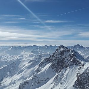
    This range is situated between 610 to 1,115 feet above the mean sea level. In this chain, the mountains are located in lower parts of Sirmour, Bilaspur, Una and Kangra districts. This hill chain has been extended upto Dehradun, Saharanpur and Haridwar.

    Pir Panjal

    It is also known as the mid-Himalayas and is called the Pangi range in common parlance. It is the longest chain in small Himalayas, which originates from Brihad Himalayas passing through Satluj on the one hand, separates Chenab, Ravi and Beas rivers. At the origin of Ravi this chain of mountains appears to be bending towards Dhauladhar. Rohtang Pass is one of the important mountains in this chain. The height of the Pir Panjal from the mean sea level is between 3,960-5,460 metres. Human dwelling can be seen even at this height. After this there is no sign of human settlements. Pir Panjal separates Kullu from Lahaul-Spiti. It enters Chamba territory on the Western border of Bara Bangahal. Pangi forms a second mountain barrier with magnificent snowy peaks, some of which reach an altitude of 19,000 feet or so. The mean elevation of the peaks is not less than 17,000 feet.

    Churdhar

    The said peak with an elevation of 3,647 metres above the mean sea level is one of the highest summits among the mountains which occupy this sub-Himalayas tract. The view from its summit embraces a vast panorama of lowland tracts on the south and a wide vista of the snowy range to the north. Churdhar range is covered with dense forests of deodar and other conifer trees.

    Brihand Himalaya

    This chain of mountains runs with the Eastern boundary of Himachal Pradesh. The height of this range runs between 5,000-6,000 metres from the mean sea level. The river Satluj also passes through this chain of mountain. The flow of Spiti River into Satluj is also cut by this chain. The important passes in this range are Kangal, Baralacha, Kunjam, Parangala and Pin-Parbati ranges.

    हिमाचल पर्देश का भूगोल – Himachal Pradesh ka Bhugol [Hindi]

    Original price was: ₹250.00.Current price is: ₹200.00.

    Zanskar Range

    This is also known as the Inner Himalayas Range. It not only separates Spiti and Kinnaur from Tibet but also is a eastern boundary of Himachal Pradesh. The Satluj River also divides the Zanskar range at Sipki. The highest hill mountains of Shilla (7,026 meters) in Himachal Pradesh also falls in Zaskar range. The mean altitude is about 18,000 feet and some of the peaks rise to about 20,000 feet.

    Kailash Mountain

    This again falls in Chini village which is the old name for Kinnaur. During certain seasons music is heard on Koksar. It is believed that the smallest of the peaks which can be seen from Chini a pool surrounded by mountains, where lies a temple of Shiva. Rocks are visible from a certain point from Chini, which turns  tinted white at sun rise, red at mid-day and green at sun set.

    The Hathi Dhar

    It is a low range, running parallel to sourth of the Dhauladhar at a distance of about 10 miles. The highest peak in this Dhar is 5,256 feet in the inner ridge of the Shivalik area. It maintains almost nearly unbroken course from the Rihlu area in Kangra to Ravi River. Near its eastern proximity a spur from the Dhauladhar joins it, almost at right angles, forming the boundary between Chamba and Rihlu. Hathi Dhar also separates Chamba from Kangra.

    Bahadurpur Dhar

    This dhar lies in the eastern most part of the district. The highest point of this range is 6,164 feet above the mean sea level. It was on this dhar that Bahadur Fort stands. The Ali Khad divides this hill into two parts. Raja Bijai Chand had his summer abode constructed near the Bahadurpur Fort. This is the highest peak in Bilaspur district.

    Bandla Dhar

    This is in Bilaspur district and its length is about 17 kilometres. The Ali “Khad” had broken into two parts and its highest peak has an altitude of 1,375 metres from the mean sea level.

    The Dagani Dhar

    It forms the boundary between Chamba and Bhadrawah in Jammu. Geographically Dagani Dhar and Chatar Dhar are different sections of one continuous offshoot forming with the Pangi range, the water shed between Ravi and the Chander Bhaga.

    Ratanpur Hill

    This range is about 11 kilometres long and the Ratanpur Fort lies on it at an elevation of about 1,230 metres. It was from this fort that General Ochterlony inflicted defeat on Amar Singh Thapa, the Gurkha leader.

    Naina Devi Dhar

    This range runs for 30 kilometres in length as the Satluj River has cuts way through it near Bhakra Parganas of Kot Kehlur and Fatehpur lie on this range.
    Koti-ki-Dhar, Janghar Dhar and Tiun Dhar- These dhars lie in Bilaspur district on its south-west.

    Sri Khand

    This mountain is situated at a height of 18,626 feet in the Pandra-Bis pargana in Shimla district. On this there is an image of Shiva on its summit. There is a stone under which offerings are made by pilgrims.

    The Central Himalayas

    The Passes of Pir Panjal Range (Central Himalaya) (Pangi Valley)

    Pangi valley is one of the beautiful valley of Himachal Pradesh and lies 33006’N and 76024’E and is at a distance of about 137 kilometres north east of Chamba. This valley is famous for its grandeur and majesty. Pangi valley lies between the two parallel mountain ranges of Great Himalayan range and the outer Himalayan range. This mighty range offers the commanding views from Dalhousie, one of the hill resorts of Himachal Pradesh. The crest of the range is mostly covered in deep snow. The only access from Chamba side to this valley is over Saach pass (4,390 metre) which remains open from May until November during the year. Pangi valley is now connected by road from Keylong and Udaipur in the Pattan Valley. Killar the headquarters of Pangi Valley, is also connected by road from Jammu and Udhampur.

    The access from Lahaul and Spiti is over Purthi and Saach villages after crossing suspension bridge over Chandra and Bhaga river at Raoli. Both these passes are easier as compared to the other passes of Pir Panjal. There are, however more than twelve passes on this mighty range connected with Chamba and Lahaul valleys. The prominent passes are Drati (4,292 metres), Marhu (4,365 metres), Keyon (4,828 metres), Cheni (4,425 metres), Saach (4,390 metres), Laluni (5,338 metres) and Duggi Pass (5,080 metres) Other very popular passes of Pir Panjal heading towards Lahaul and Spiti valley from Bharmour (Chamba district) are Kugti (5040 metres), Chobia (4966 metres), and Kalichho Pass (4,990 metres). Pangi is known for its un-spoilt and distinct culture. The principle deity of Pangi valley is Mindla Devi, which is worshipped by all Pangwals. Pangi valley has one of the biggest forest cover of Himachal Pradesh. The valley is treasure of herbal plants, dry fruits and rare botanical species. The valley also presents a unique glimpse of its rich flora and fauna. Rare herbal plants like Kuth, Pateesh, Panja, Guchhi, Sheelajit, Kahru, Patti, Guggal Dhoop and Kala Zeera are grown in abundance. Dry fruits like Thangi, Chilgoza, Walnut, Almond, Khumani, Piyanth, Plums, Zamun, Strawberry and Apples are produced in plenty.

    Peaks around Dharamshala/Dhauladhar

    There are number of peaks in this region. The heights of these peaks vary between 4,500 metres to 5,000 metres. The peaks Dhauladhar, Matter horn or Gauri Junda (4,916 metres) is located to north east of Dharamshala and is the highest peak is Dharamshala. The other prominent peaks are Slab (4,560 metres), Rifflehorn (4,500 metres), Two Gun (4,490 metres), Camel (4520 metres), Authur Seat (4,525 metres) and Chirsmas (4,581 metres). These peaks are accessible almost throughout the year. The other peak is Mun peak (4610 metres).

    Gaj Pass (4,243 metres)

    Gaj Pass is located to the left side of the Bhim Ghasutri Pass (4,580 metres). If one walks to the right of the Gaj Pass, one can visit a very beautiful small round lake called Chanderkup or the moon lake; located almost on the top of the ridge. One can further descend through a bouldered trek to reach Lama Dal.

    Sari Pass (3,760 metres)

    Sari Pass is not very high. Sari “nullah” meanders in between the valley and finally mingles with Beas river at Kullu.

    Indrahara Pass (4,350 metres)

    Indrahara Pass is accessible from May until November. This pass provides a very scenic view of both Kangra and Chamba valleys and offers distant view of the middle and Greater Himalayas. There are a number of peaks like Dromedary, Camel, Two Guns, Rifle Horn, Cairn, Slap, Arthur’s Seat and Arthur’s Stool and Mun to both sides from Indrahara Pass. On the Pass are few Trisuls offered by the devotees of Lord Shiva to Indra (the rain God).

    Minkiani Pass (4,250 metres)

    Kareri Lake is at the foothill of Minkiani Pass and to the left side of the lake the trek goes to Bleni Pass (3,710 metres). One can approach the Minkiani Pass through steady and stiff climbing over snowy and steep rocks.

    Bleni Pass (3,710 metres)

    Bleni Pass is situated left of the Kareri Lake. The Bleni pass is at a low altitude and is an easier Pass. Mighty Dhauladhar range declines in altitude to a considerable degree towards northwest beyond Bleni Pass. This snow-clad mountain range turns into a thickly wooden ridge affording an easy access over its passes, like Salooni; Bohar, Loa and Kalinali (all in jurisdiction of Chamba district) with a mean elevation of 3,000 metres to 3,500 metres towards Ravi valley. The Dhauladhar in its westward reach separates Kangra from Chamba and ultimately descends to the southern banks of Ravi near Dalhousie.

    Bhimghasutri Pass (4,580 metres)

    Bhimghasutri is a different pass of the Dhauladhar range located to the north of Dharamshala. The ascent to this pass is vertical with sharp rocky cliffs and dangerous gorges. This pass stands between Riffle Horn peak and Gag pass. Legend has it that Bhimghasutri Pass was named in the memory of Bhima. (one of the Pandvas brothers) who glissed the sharp-edged ridged of this pass to leave an even path for the rest of his brothers.

    Kundli Pass (4,550 metres)

    Kundli Pass lies at an elevation of 4,550 metres and it stands between Mun Peak (4,650 metres) and Toral Pass (4,375 metres) facing Dharamshala. The ascent to the pass is steep from Dharamshala side and moderate from Kwarsi village (Chamba district). The shape of the pass is like snake coil or kundli” hence it is named the Kundli Pass.

    Toral Pass (4,375 metres)

    Toral Pass lies to the northeast of Dharamshala. This pass stands to the right side of the Kundli Pass. The ascent to the pass is demanding and involves crossings over many steep ridges below which lie deep gorges. While crossing through this pass, Gaddis always pay their obseisance to Toral Devta (a deity), whose abode is at the top of the pass. One goat is reserved to be sacrificed in the name of Kailashpati (Lord Shiva) for bestowing peace.

    Talang Pass (4,643 metres)

    Talang Pass is one of the highest and difficult passes on the Dhauladhar range. This pass is located at the head of the Ban Ganga river and north of the main Chamunda temple between Narwana, Jia and Holi. This pass rises abruptly from an elevation of 2,500 metre to 4,643 metre. The name of this pass is derived from a deity Talang whose abode is supposedly at the top of the pass and who is largely worshipped by the local people.

    Waru Pass (3,850 metres)

    Waru Pass lies to the east of Palampur. Waru means, “Gateway of wind” and winds with very high velocity blow over the pass. Satchalli is at the foothill below Waru Pass and enroute to the pass all vegetation comes to an end from Satchalli, the pass involves a steep climb.

    Singhar Pass (4,473 metres)

    Singhar Pass lies to the north of Waru Pass. This pass is one of the difficult passes of the Dhauladhar range. Through the pass one can cross over to Mani Mahesh and Lahaul-Spiti. Singhar, the “Killer” according to the local people is very unpredictable pass and one cannot be sure of weather conditions on it.

    Chobu Pass (4,750 metres)

    From Chobu Pass one can view the Kailash Peak (5,656 metre) and surrounding ridges. Manimahesh lake is also visible from this pass. From the pass, the route goes downward to the base of the Kailash peak.

    Thamsar Pass (4,704 metres)

    Thamsar Pass is known for mid-day winds and bad weather. Gaddis flocks enter from this route to cross Thamsar Pass to Bara Bangahal.

    Makori Pass (4,444 metres)

    Makori Pass lies between Barot and Bara Bangahal. Makori pass is less frequented in comparison to other passes of the Dhauladhar. From Makori pass the terrain is trackless.

    Saach Pass (4,390 metres)

    Broadly speaking from Chamba side inlet to Pangi valley is over thin pass. Satrundhi is situated at the foothill of Saach pass.

    Kalichho Pass (4,990 metres)

    Kalichho,”The abode of Goddess Kali,” is one of the difficult passes in the Pir Panjal range. One can cross over to Kalichho Pass from Bharmour to Trilokinath (Udaipur). Ideal time to cross this pass is from July to October end. While descending the Kalichho Pass one can behold the Pattan Valley with meandering Chandra-Bhaga river and beautiful snow-capped mountains.

    Chobia Pass- (4,966 metres)

    Chobia Pass is one of the difficult passes of the Pir Panjal range. This pass stands between Bara Kanda Peak (5,877 metres) and Tent Peak (6,133 metres). Chobia is the last village inhabited
    Kugti Pass (5,040 metres)- Kugti Pass is a tough pass of the Pir Panjal range because of its high elevation and steep gradient. Kugti means, “that which makes one miserable to reach it”. If weather deteriorates while negotiating the pass, the climb becomes dangerous due to sudden drop in temperature, poor visibility and snow storms. From the pass, one can see the snow capped mountains to the far end towards Lahaul and Zanskar.

    Kalihen Pass (4,670 metres)

    It is a high pass but not difficult. This pass was used by the local Gaddis on their way to Kullu. Gwari is situated at the foothills of Kalihen Pass where the Kalihen stream originates and joins the Ravi river near Bara Bhangahal.

    Tentu Pass (4,990 metres)

    Tentu Pass is situated above Manali at an altitude of 4,990 metres) above sea level. From the pass, one can see the views of Central Lahaul Peaks, Indrasaan and Deo Tibba. One can have a clear view of Pir Panjal and Dhauladhar range from Tentu Pass and there is route to go to Bara Bhangahal from here.

    Sara Umga Pass (5,010 metres)

    This pass lies towards north east of Bhuntar and one can reach to Keylong over Sara Umga Pass from Manikaran. On the way are Budhaban and Losha Thatch. One can have the close views of the Ali Ratni Tibba, located on the Pir Panjal range. On the route of this pass one can see Bara-Shigri glacier one of the biggest glacier in Himachal Pradesh.

    Pin Parbati Pass (4,802 metres)

    This is one of the most rugged and difficult passes having very steep ascent and is beyond habitation after Pulga. From this pass one can reach to spiti. This is the only route that connects Kullu valley with the Pin valley of Spiti, the shortest route.

    Hamta Pass (4,480 metres)

    This pass is not very high. One can start to Hamta Pass from Prini Village only 4 kilometres from Manali to Keylong and on the way lies Hamta Pass. This pass offers distant views of the Central and Great Himalayan ranges. The views towards the peaks around Lahaul, Manali and Kullu areas are captivating.

    Asha Gali Pass (5,830 metres)

    Asha Gali Pass is situated on the way to Keylong, Manimahesh and Bharmour side. The pass offers magnificent views towards Chamba Kailash (5,656 metres) and Bharmour region.
    Shingo La (5,100 metres)- Shingo La lies between Chhumik Nakpo and Lakong and it is a difficult pass.

    Mon La Pass (5,460 metres)

    The pass can be approached from Miyar valley along the Miyar Nullah. This beautiful valley is extended upto Urgus and Khanjar. One has to cross Mon La or Kang La to enter Padum.

    Baralacha Pass (4,896 metres)

    Baralacha is connected by Manali-Leh road. This is the only pass, which gives rise to Chandra, Bhaga and Yunam rivers. At this Junction, one leaves Chandra valley and enters into Bhaga valley. From Baralacha the route proceeds along the left bank of Yunam river.

    Rangcha Gali Pass (4,536 metres)

    Rangcha Gali Pass lies between Keylong and Khoksar. Local people believe that Guru Ghantapa one of the 84 sidhas of Buddhism attained sidhi at this place. From the pass it is a steep descent to Gondhala.
    Lach Lang La- From Gyam a very steep climb is followed upto the pass. The whole area is rugged and barren without any meadows and grass on the surface.

    Kang La (5,460 metres)

    This is very tough and taxing La. This pass, like other passes, offers significant views of the great Himalayan ranges. The trek to the side of the pass has a very steep descent. One can approach Kang La from Phalaphu.

    Shin Kun La

    This pass lies between Darcha and Padum. The descent after the pass is torturing.

    Nimish Khango Pass (4,890 metres)

    This pass falls in the restricted zone of Spiti valley and is a site for the hydro electric generation power house. It lies between Kaza and Kalpa.

    Panktil Pass (4,010 metres)

    From Rang Bar (Spiti valley) a tough climb of about 5 kilometres leads upto Panktil Pass. One can enjoy the panorama of Rupa and Chuktyanjan river that flows down from the north west. One can also see Manirang and Singikhang peaks also form a part of the drainage of the Himalayas.